Sunday, May 6, 2012

History of Moraines,Outwash Plain, and Shorelines.

The history of all the moraines goes back to when the land was covered in glaciers. They were formed during 2,400 year period ,called the Crown Phase, that all started about 15,200 years ago. The highest and the largest of them is the Valparaiso moraine. It was formed at the beginning of the crown Phase when huge piles of sediment were piled up along the edge. The valpo moraine is composed of sand that is covered by glaciers till. This moraine is over 200 miles long. The next moraine that was created due to more glacial retreat was the Tinley and Lake Border Moraine. The Tinley/Lake Border moraine is not as high and is also narrower. Many towns in the area took their name because of their placements on these moraines.
South of the Valpo Moraine is the kankakee outwash plain. This carried the meltwaters away from the glacier. It was formed because of the waters cutting through the moraine and depositing sand. All the meltwaters escaped on the Kankakee river which in turn merges with the Des Plains river which empties out into the Mississippi river and then into the Gulf Of Mexico. Before all the draining it was the largest freshwater marsh in the country. It was a problem in early settlement but now produces good hunting and fishing.
There are 3 old shorelines to lake Michigan. They are the Glenwood, Calumet, and Tolleston Shorelines. The oldest lakeshore is The Glenwood which happened about 14,400-12,200 years ago. It is the highest of the shorelines at 640 feet. The first beaches that were formed on this shoreline were the Dyer and Schererville. It got its name because the best kept beaches were along Glenwood-Dyer Road.
The next shoreline to form was the Glenwood Shoreline. It stood at 620 ft which is 20 ft higher than what it is today. This shoreline got its name from the Calumet River that was nearby. The sand from this was moved to fill wetlands to help with settlement in the area. all the beaches on the Calumet are much smoother than on the Glenwood. Both of those shorelines were formed near each other where in spots the Calumet buries the Glenwood. This shoreline is mainly what Ridge Road is today.
The last and youngest of the shorelines is the Tolleston Shoreline. It stood at 605 ft and is the smallest of all 3 shores. It was the first barrier beach in Lake County. Even though it is the smallest shoreline it still stands 25 ft taller than Lake Michigan does today. Beacuse of the way it formed and being a spit/barrier, it had the lake to the north and formed the calumet lagoon in the south. About 3,800 years ago the lake lowered to its current level. There was a pulsating pattern that created more than 150 small beach ridges and were all mainly parallel. The water level finally leveled off and reached it current level about 1,500 years ago. about that same time a spit formed and closed off Lake Calumet.  Then 400 years later the same thing happened to cause Wolf Lake. There were dunes that formed off the lakeshore in Porter County,which has the tallest dunes which are Indiana Dunes State Park, and LaPorte County, which has Mt. Baldy which is migrating little by little every year.
 Schoon, K. J. (2003). Calumet beginnings. Bloomington,In: Indiana Univery Press.
http://ebeltz.net/folio/fig14.jpg
 Map Of The Area

Sunday, April 29, 2012

Human Interaction

Man came into the area and transformed it for the best. They turned old trails into major routes through the area. They were able to get from one place to another much quicker because of this. Because of the trails they built up cities. The area due to the lake became a transportation hub.The also built mills blacksmith shops and other needed shops for the people in these towns.They used the area to farm. The trains came into the area and boosted population and built up more towns. They used the lake for fishing. There was 3 canals built in the area. They were to help ships and settlers move across they area. They were the Illinois and Michigan, the Chicago Sanitary and Ship, and Cal sag channel. The only one in Indina was The Indiana Harbor Ship Canal.There were damns built on lakes around the area to help certain towns get water. Also areas built ditches like Hart ditch in Dyer for drainage. They also built plent of ports on the lake to get products by ship into the area.
Well i grew up in Hessville since i was 5. The tolleston shore line runs through most of Hessville. Gibson station was a major passenger station for the railroads. David and Elisabeth Gibson built a house near the station in 1845. In 1850 Joeseph and Mary Hess opened a bakery and restaurant near that station. Gibson opened a post office in 1857 and until 1873 they got their mail from Gibson because Hammond opened their post office. The town was founded in in 1852 when  Michigan central line was completed to Chicago and Gibsons business declined. The Hess' moved south and opened a store and started the town on the shoreline. Hessville was built up due to trains and finally got its own line until 1882. It got two more rail lines in 1906. when 1911 rolled around the City of Hammond wanted to annex the town. Citizens held an election on the subject in 1918 and it passed with 78 votes for and only 2 against. Hessville became a part of Hammond in 1923.
The area is rich in materials which is why people moved here.The area was very rich with trees. First settlers came in and made a living off of cutting down the trees. It helped make room for the houses and towns they were to build. The people who moved along the calumet shoreline had a lot of work to do they had to remove sand to be able to build their houses. The sand that was moved was used as fill in local marshes. These sand ridges posed a huge problem. They were also cut through to make trails/roads in the area. That sand was then moved to the low wetlands to raise the railroads.there was and enormous amount of sand moved out and around the area. Another thing the area had an abundance was clay. Many towns in the area found this out quickly and used it to their advantage. They used this clay to make bricks that went into making houses around the area.
Man has contaminated the area over the years. Water has been poised and areas just flat out reuined. The mills have played a vital role in this by polluting water and air along with land. Many corporations in the area have polluted the land so bad that it cant be used for many years. Because of contamination to the land, it seapted into the water supply and killed and harmed many people. They have cracked down on the pollution in the area over the years. The air has gotten bad becuase of BP Amaco, all the steel mills and all the traffic of the area. There have been many companies that would dump illegally or even pollute the ground.
                Schoon, K. J. (2003). Calumet beginnings. Bloomington,In: Indiana Univery Press.
http://www.virtualtourist.com/travel/North_America/United_States_of_America/Indiana/Hammond-782076/Things_To_Do-Hammond-TG-C-1.html
                                                 The Little Red School House in Hessville

http://illinois.sierraclub.org/calumet/park/index.html
A Map of the Area.

Wednesday, April 25, 2012

Cedar Lake

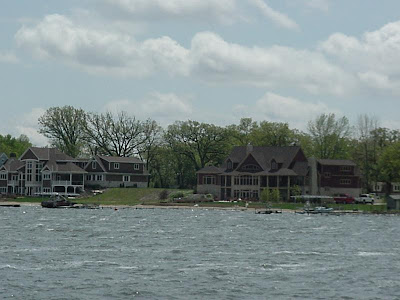
Cedar Lake, Indiana has built up around one focal point and that is its lake. This lake is rare in the part of the nation and was formed when glaciers retreated and left the area flat and dry. Cedar Lake holds a record in Indiana as being the states largest inland natural lakes. There is a marsh to the south of the lake which used to be part of the lake at one time. This marsh is the largest continuous wetlands in the state. The town has built up around the natural feature from when 1870's when pioneers first settled in the area. The Monon Railroad brought another population increase in 1882. From the late 1800's into the 1900's cedar Lake became a resort town and built up around the lake. The town really started to boom in commerce. It turned into quite the resort town. The citizens tried to incorporate the town and didn't get that accomplished until 1970. The town hit a decline where all the resorts closed along with nearly all the businesses around the lake. By 1990 nothing was left around the lake. The resorts that were left turned into year round housing instead of being seasonal. Through the rest of the 1990's there was an increase of housing developments due to people leaving the city and moving into the suburbs. Cedar Lake continues to grow again.

http://www.cedarlakein.org/Home/History.aspx
                            Cedar Lake Today
http://activerain.com/blogsview/678759/old-cedar-lake-indiana

Indiana Dunes

The earliest accounts of people in the dunes would be for hunting trips from 200 to 800 BC. Eventually European settlers changed the area for good. They came here for trade. Problems within Indian tribes and typical European competition brought the movement west. Others did try to take over the large trading area. The dunes still maintained to be a big and prominent hunting ground. Once we got into the 19th Century Indian settlements were still in the area but the Europeans started to invade the area, with the first settler being Joseph Bailly. He came from around Niles, Michigan and setteled along the Calumet River like many people. The build up of the area created the formation of Chesterton,, Porter, Tremont, and the Town of Pines. The area has expanded a lot over the years, which settlement took up the whole lake-shore bringing homes, industry and parks. They are trying to preserve the Dunes due to the sand drifting. They have hauled in sand to compromise for the drifting. There are sections closed to the public to keep them from transporting the sand any more than the natural wind movement.

http://en.wikipedia.org/wiki/History_of_the_Indiana_Dunes
                           Indiana Dunes at Mt. Baldy
http://www.dailyinterestingfacts.com/places/indiana-facts.html

Thornton Quarry

The first people moved into Thorton Illinois in 1834. The first quarry open two years later but what shut down due to the poor quality of the rock and how deep it actually was. Fred Gardner opened one in 1846 and then Stephen Cray opened another one in 1850. Then in 1920 Colonial Hodgkins bought the quarries. Four years later the part north of Ridge Road opened and then in 1926 a tunnel was constructed to connect the two. Hodgkins died in 1929 which led to Brownell Improvement Company re-buying the quarry, they originally owned it in the early 1900's.  Last in 1938, Material Service Corporation bought the quarry and have owned it ever since.
The quarry was originally made out of limestone and a lot of old dead coral that once consumed the area. They have found fossils and a meteorite there.They use the quarry for many different types of building materials. The quarry is part of the Chicago Deep Tunnel project, which is a  resivour for sewage and water runoff to be used the city. The capacity was 3.1 billion gallons of runoff but by 2014 it should have the capacity of 4.8 billion gallons.
http://www.lib.niu.edu/2002/ihy020232.html
                               A View Into The Thornton Quarry
 http://achicagosojourn.blogspot.com/2009/06/quarry-town.html

Sunday, April 15, 2012

Why Did They Go Extint?

With the reasearch I did i found three ideas to how they went extinct and i see that ll three are very logical. You cant just blame a single reason why these animals went extinct. The three reasons are human interaction, climate change and last disease. First human interaction would be more along the lines of hunting. With people now hunting them to survive, their numbers would deminish. Another reason that would effect them is because they would gather the fauna that some of these animals would eat and they would have no food. Same goes for the carnivors, they would hunt their food. So food became scare for these animals. The second reason would be climate change. The galciers were melting which would mean temperatures were rising. Also precipitation patters were changing. These changes would effect the food, reproductive cycles, and they were forced to live in conditions they werent adapted or able to live in. The last idea would be disease. As the people interacted with the native fauna they would pass disease on. The aminals werent adapted to this disease and being new to it, it just wiped them out. We saw this as we came to this country and nearly wiped out the Native American population. Honestly who knows which of these are correct. It may just be one or a combination of all three. The world may never know.
http://exhibits.museum.state.il.us/exhibits/larson/LP_extinction.html


Extinct Animals


There were a large group of animals that once live in Indiana. They all disappeared by the end of the Ice Age. The only remaining traces are bones and what we see in museums. A few of the animals migrated north as the glaciers were retreating into Canada. I was shocked at some of the animals that lived in the state. Only a few i new anything about. Most of them i have never heard of and had no clue about them. The two that lived in the area and migrated north were the musk ox and the caribou. We still see them around today in Canada and the Arctic. The list of the animals that lived here that went extinct include the American mastodon, the Colombian mammoth, the dire wolf, the saber tooth cat, the long nosed peccary, the flat headed peccary, the giant short faced bear and the Jefferson's ground sloth.

Wednesday, April 11, 2012

N-S Transect

Tolleston Shoreline 169th St and Indianapolis Blvd
                                            Image from  Google Earth
Calumet Shoreline at U.S 41 and Ridge Rd.


Glenwood Shoreline and Tinley Moraine at U.S 41 and Rt 30.

Valparaiso Moraine at U.S 41 and  Rt 231

Kankakee Outwash Plain at Indiana 49 and Rt 30.